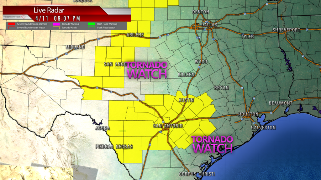
A tornado watch has been issued for portions of central and south Texas until 4:00 AM Sunday, April 12, 2020.
A few tornadoes likely with a couple intense tornadoes possible
Widespread large hail and isolated very large hail events to 3
inches in diameter likely
Scattered damaging winds and isolated significant gusts to 75
mph likely
A few intense supercell thunderstorms are expected to
track eastward across the watch area through the late evening and
overnight hours. Storms will be capable of very large hail and
tornadoes, along with locally damaging wind gusts.
PROBABILITY TABLE:
PROB OF 2 OR MORE TORNADOES : 70%
PROB OF 1 OR MORE STRONG /EF2-EF5/ TORNADOES : 50%
PROB OF 10 OR MORE SEVERE WIND EVENTS : 70%
PROB OF 1 OR MORE WIND EVENTS >= 65 KNOTS : 60%
PROB OF 10 OR MORE SEVERE HAIL EVENTS : 80%
PROB OF 1 OR MORE HAIL EVENTS >= 2 INCHES : 70%
PROB OF 6 OR MORE COMBINED SEVERE HAIL/WIND EVENTS : >95%
Tonight’s Main Threats:
- Tornadoes — EF-2 or greater
- large hail – 2″ in diameter (egg-sized) or greater
- Damaging winds – +70mph or greater
- Frequent lightning
- Heavy rain (1″-2″) with minor localized flooding (KXAN)
- Make Sure You Have:
- Phones charged
- move cars inside garage if possible
- bring pets inside
- Have flashlights available if power goes out
- Move outdoor furniture close to house or inside if possible
- A way to get weather alerts. Have a safe place to go in the innermost part of your home if needed (without windows, such as under the stairs or a closet)
- Remember night storms/tornadoes are quite dangerous because you cannot see them.
- Stay safe everyone!